WINTER 2009
A Newsletter from the Federal Highway Administration (FHWA)
www.gis.fhwa.dot.gov
A Look at PennDOT's Road Condition Reporting System
This month's Q&A is with Frank DeSendi of the Pennsylvania Department of Transportation (PennDOT). He discusses the Department's Road Condition Reporting System (RCRS).
Quarterly Webinar
On November 13, 2008, FHWA hosted its first quarterly webinar on GIS in Transportation. The topic of the webinar, during which Florida DOT gave a presentation to over 70 participants, was enterprise GIS at DOTs. More information can be found here.
The next webcast is being scheduled for late winter 2009.
Q. What is this application and how is it used? A. RCRS is Pennsylvania's first and only technology application that offers consistent and accurate road condition information for planning and reporting purposes. RCRS allows PennDOT to report road closures, lane restrictions, highway conditions, construction activities, and bridge failures and closures to outside agencies and the general public in a uniform method. Never before has PennDOT had a technology application that could bring together all of the roadway information in one central location, provide a quick and easy way to extract information, and immediately offer a visual display of the roadway. The system improves data integrity, provides better security, reduces errors, and allows for 24/7 access to the information.
Q. Who currently uses RCRS? A. RCRS is available from any PennDOT intranet location and various locations in other agencies, making the data quickly available for PennDOT district engineering offices, the Pennsylvania Emergency Management Agency, and the Pennsylvania State Police. Additionally, the application can send automatic alerts at defined intervals to help improve communication throughout the chain of command. RCRS is designed to store information on a wide variety of conditions, including weather-related road surface conditions, construction and maintenance work, traffic incidents, and road closures.
Personnel throughout PennDOT regularly enter condition information into RCRS, which provides the data for PennDOT's interstate road conditions phone hotline, the public traveler information page on PennDOT's Website, and e-mail notifications to executives and appropriate staff at PennDOT and partnering agencies. Armed with this information, travelers can make the best decisions when planning their routes and determining travel time. Likewise, law enforcement and emergency response agencies rely on the information in RCRS to establish the quickest and most direct route when responding to an incident or event.
Q. Who brought RCRS to completion? A. The creation of the web-based RCRS application was the result of a collaborative effort among various PennDOT bureaus, engineering districts, and the Pennsylvania-based consulting firm GeoDecisions. The use of RCRS throughout PennDOT has ensured consistency and accuracy when reporting road closure and road condition information throughout the state. Captured information, such as the road closure beginning and ending points and the estimated time when the road will be reopened, can be displayed on an interactive map or through detailed text listings. The application was implemented in October 2007.
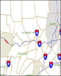 Screen capture from RCRS
Q. What factors contributed to having it developed that way? A. In the past, PennDOT faced a number of challenges to effectively and efficiently report road closures and conditions. The previous system was a labor intensive, manual system that used spreadsheets in both paper and electronic format to maintain and disseminate road closure information. This method caused errors due to lack of validation of data and overall discrepancies based on the amount of time required to collect, collate, organize, and distribute the information. Additionally, there was no standardized format to the findings, making it difficult to distribute relevant information effectively. This process of updating would take anywhere from hours to days and ultimately led to a lack of available accurate information during times of adverse weather. Due to these factors, PennDOT sought out GeoDecisions to partner with for the development of RCRS.
Q. From where do you obtain data for RCRS? A. Data for RCRS is obtained from various PennDOT bureaus. RCRS users input data relating to current field conditions. The RCRS database is part of the PennDOT GIS database. The GIS database enables RCRS information to be analyzed with other business data or displayed on-line or in hard copy, based on operational needs.
Upcoming Events
- A Geographic Approach for the Nation, February 18-20, Washington, D.C.
- AASHTO's Annual GIS for Transportation Symposium, April 5-8, Oklahoma City, OK
Q. Has RCRS met the business and/or technical needs of PennDOT? A. RCRS has met the needs of PennDOT. Since the implementation, RCRS has become PennDOT's standard tool for tracking and reporting roadway information. The application streamlines the tracking and reporting process, improves accuracy of the information, allows viewing of closures on a statewide map, expands reporting capabilities, and ensures consistency of the data provided.
GeoDecisions has provided on-site development support at PennDOT's headquarters for the implementation of RCRS. The staff members provided PennDOT users with day-to-day experiences and knowledge sharing, thereby exceeding typical technical support and enhancements to the application.
The daily interaction and professional relationship between the staff and PennDOT employees has made for effective coordination of updates and application testing. Because of this partnership, PennDOT is now on the leading edge of GIS technology in the state transportation community. Moreover, RCRS represents a valuable tool in making Pennsylvania's highways safer.
Q. What have been the lessons learned while developing RCRS? A. RCRS' use of GIS offers its users a more complete picture of the state's roadway system. Through this tool, PennDOT personnel have the ability to report on road closures, lane restrictions, construction and maintenance activities, as well as interstate winter roadway conditions-greatly improving the efficiency and effectiveness of communications associated with managing incident- and weather-related closures.
Q. Are there plans to modify RCRS? A. To meet the changing needs of current and future users, RCRS was built in a simple, flexible manner. New information can easily be added and the application can be updated as needed. A decision was made not to build RCRS as a desktop application, which would require formalized training, licensing considerations, and continual updates. With the user-friendly, web-based interface, only minimal training is required to administer the system. Current enhancements are already underway. These enhancements to the application include adding dynamic message boards, cameras, and highway advisory radios. The new version of RCRS will be completed by the end of 2008.
FHWA Guest Editorial
Welcome to the first issue of the GIS in Transportation Newsletter! The purpose of this newsletter is to help you learn what your peers are doing with geospatial technologies, why they use them, and how they use and implement them. We also want you to know about meetings, workshops, conferences, and training opportunities that deal with geospatial technologies. In past workshops, peer exchanges, and case study interviews we have done, we noticed that participants expressed a common desire to better understand the state of the practice and learn from others' experiences. This newsletter is one way we will try to address this need.
In each issue we will highlight a specific application of GIS or geospatial data and technology from a State department of transportation, metropolitan planning organization, or other transportation agency. Each issue will typically be in a "Question and Answer" format. Issues will have guest editorials about topics that relate to geospatial technologies and their use in transportation agencies. Information about upcoming and recent events, as well as recently released reports, will also be included. We will also provide a link to the GIS in Transportation website (https://www.gis.fhwa.dot.gov) where you can find out more about our outreach activities.
Like many things, the newsletter will be a work in progress. If there is something you would like to see, something you would like changed, or something that could be improved, please let us know. We want to make this useful for you.
— Guest Editorial from FHWA's Office of Interstate and Border Planning
Recent Reports
Over the last six months, FHWA has released three reports related to applications of GIS for transportation decision-making purposes. These reports, listed below, are available along with many others at FHWA's GIS in Transportation website: www.gis.fhwa.dot.gov. Visit the site to learn more about these reports, as well as to submit information about your agency's transportation GIS applications.
GIS Applications for Transportation Right-Of-Way (September 2008) — This report provides a summary of a 1.5-day follow-up peer exchange held in July 2007. The peer exchange was sponsored by the FHWA's Office of Interstate and Border Planning and Office of Real Estate Services.
Key Practices for Implementing Geospatial Technologies for a Planning and Environment Linkages (PEL) Approach (July 2008) — This report presents three case studies that illustrate how GIS has been used to implement the FHWA's PEL approach.
Business Models for Implementing Geospatial Technologies in Transportation Decision-Making: Phase Two (March 2008) — This report describes a number of state DOTs' business models for implementing geospatial technologies in transportation decision-making.


